Exhibits
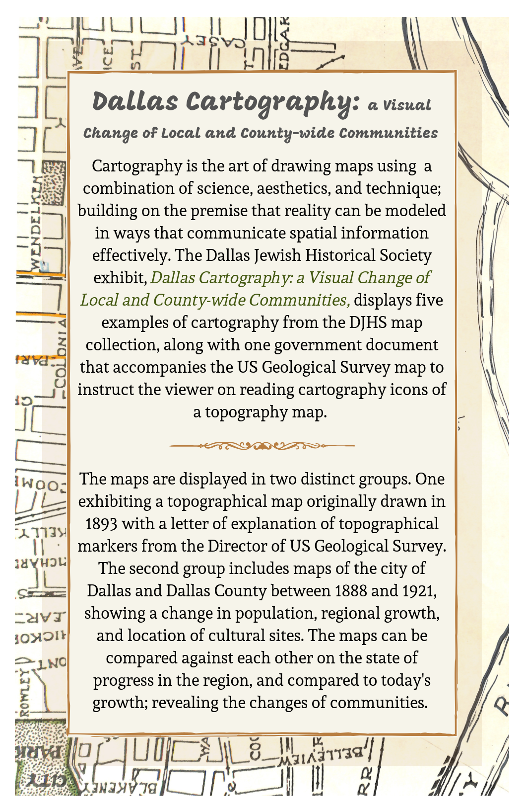
Peruse the galleries to view the exhibit as it is displayed, as well as individual images of the items.


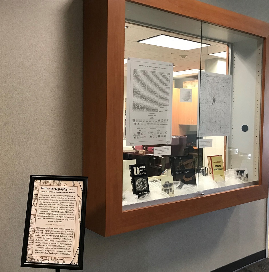
Originally drawn in 1893 and reprinted in 1902, the United States Geological Survey topographical map presents Dallas County with city, road, and elevation makers. A closer look reveals to viewers water and man-made features characteristic to topography and topographical maps. The accompanying letter from 1899 US Geological Survey Director, J.W. Powell provides a description of topographical cartography markers.

Description of the Topographic Map of the United States, 1899. Reproduction, 1980. Original copy part of the Dallas Public Library History Division. Dallas Jewish Historical Society Collection
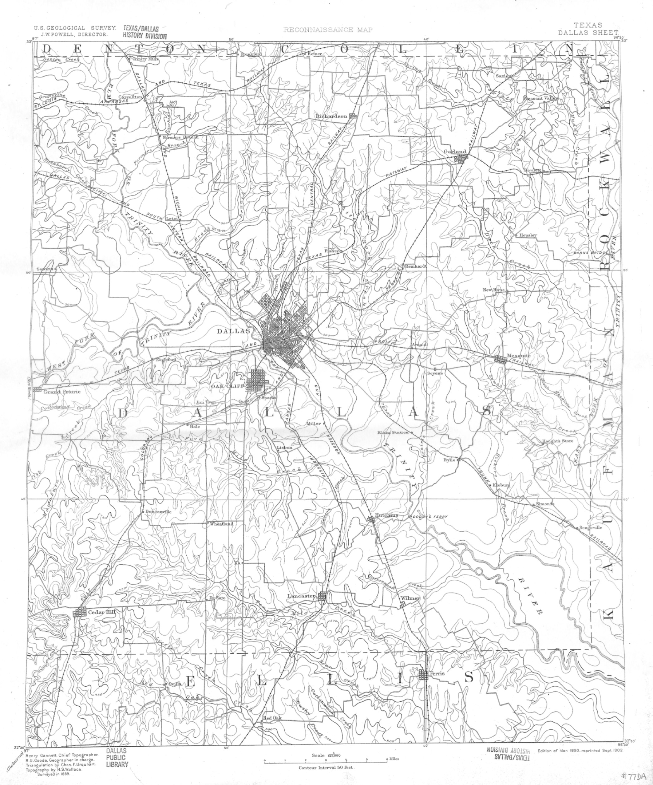
United States Geographical Survey Reconnaissance Map, 1893. Reproduction, 1980. Original map part of the Dallas Public Library History Division. Dallas Jewish Historical Society Collection.
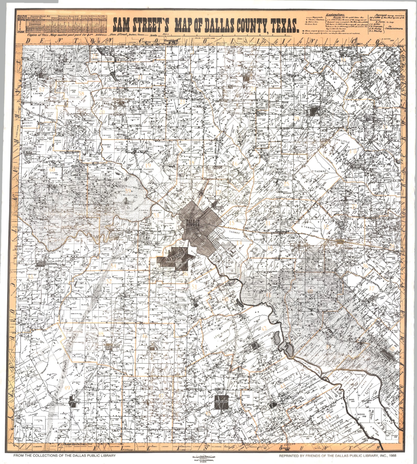
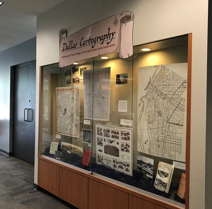
Sam Street’s Map of Dallas County, Texas, 1900.Reproduction, 1988. Original map part of the Dallas Public Library History Division. Dallas Jewish Historical Society Collection

Dallas Ry. Co’s Key and Guide to Dallas, 1921. Reproduction, n.d. Original map part of the Dallas Public Library History Division. Dallas Jewish Historical Society Collection.

Birds Eye View of Dallas, Texas looking east, 1888. Reproduction, 1989. Original map part of the Dallas Public Library History Division. Dallas Jewish Historical Society Collection.

Untitled Map, n.d. Historical reference for DJHS Bus Tour. Dallas Jewish Historical Society Collection.
Each of the four exhibited maps can tell their own story of growth and progress for the city of Dallas and communities within Dallas County. Together they tell a larger story of growth and change in and between communities.
For instance, the yellow highlighted streets on the Bus Tour map were once an area known as “Little Jerusalem” filled with Jewish-owned businesses, which is now known as “Little Mexico” for the large Hispanic community that lives there today.
As the city grew, established communities moved to newer areas and new cultural populations moved into the older neighborhoods.

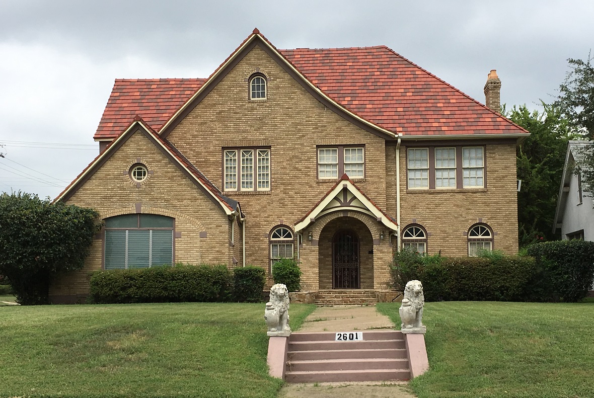
Home on South Blvd. in South Dallas, c. 2017, Dallas Jewish Historical Society Collection
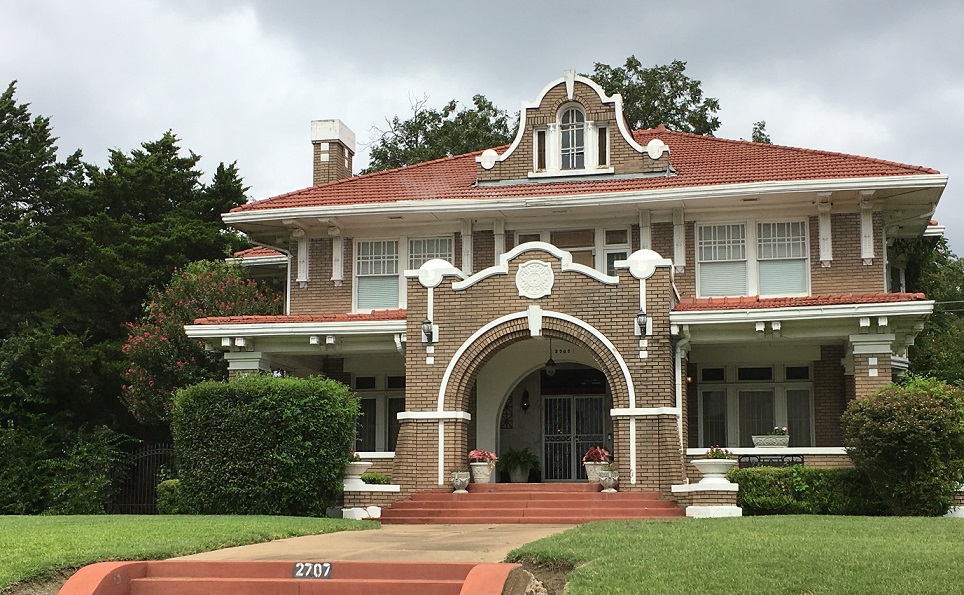
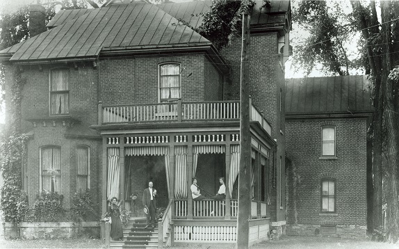
Harris Home in the Cedars, c. 2017, Dallas Jewish Historical Society Collection
Home on South Blvd. in South Dallas, c. 2017, Dallas Jewish Historical Society Collection
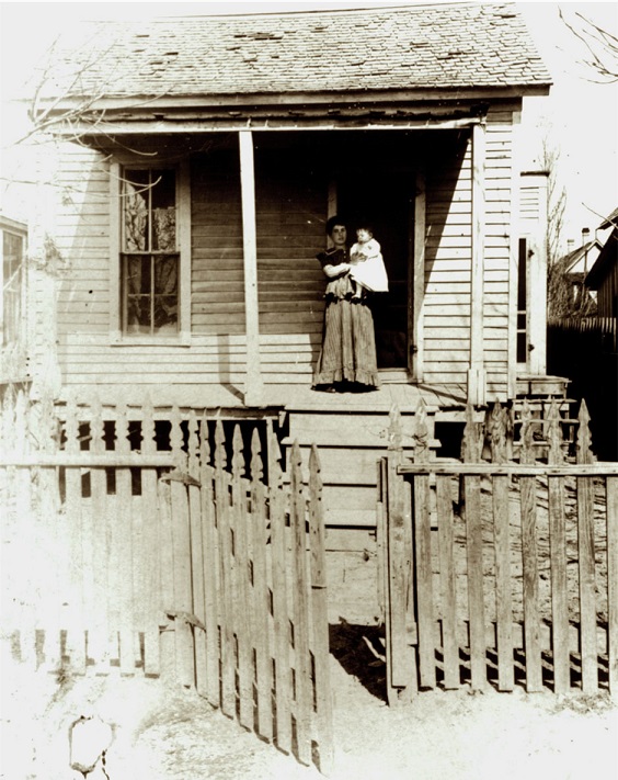
Wyll Home on Caroline Street, c. 1908, Dallas Jewish Historical Society Collection

Harris Home in the Cedars, undated, Dallas Jewish Historical Society Collection

Dreyfuss House at 2831 South Ervay, donated to the Visiting Nurses’ Association in 1939, Dallas Jewish Historical Society Collection
Yonack Home in South Dallas, undated, Dallas Jewish Historical Society Collection

S. H. Kahn Home on Akard Street, undated, Dallas Jewish Historical Society Collection

Home in South Dallas, c. 2017, Dallas Jewish Historical Society Collection